
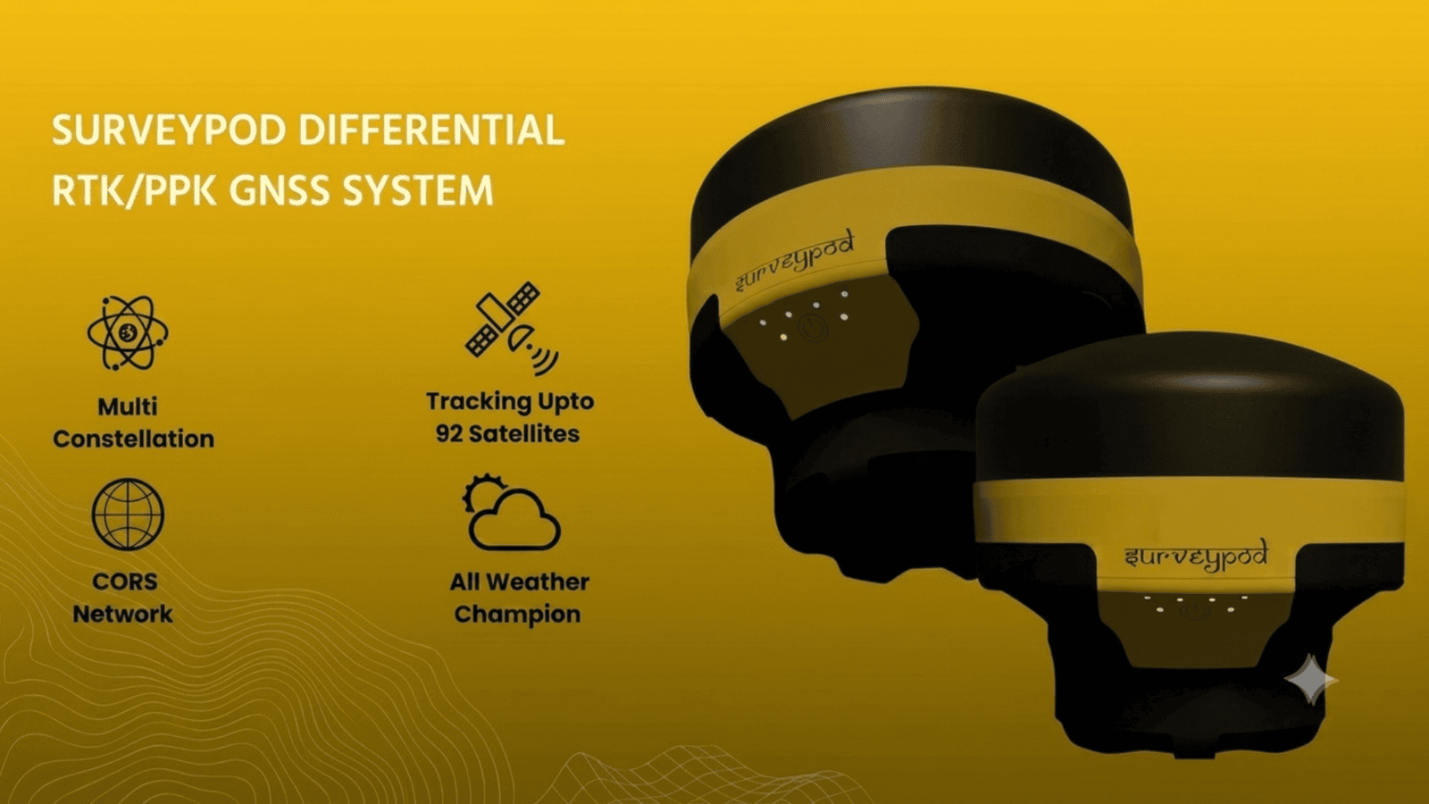
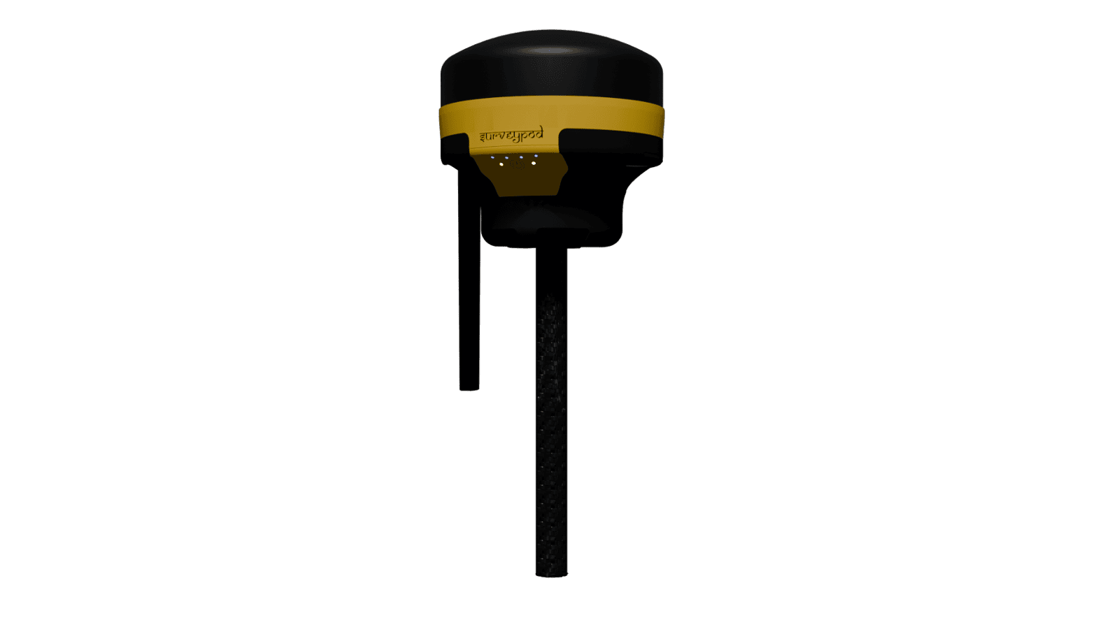
SURVEYPOD DIFFERENTIAL RTK/PPK GNSS SYSTEM
Multi
Constellation
Tracking Upto
92 Satellites
CORS
Networ
All Weather
CHAMPION
HIGH ENDURANCE

SURVEYPOD DIFFERENTIAL
RTK/PPK GNSS SYSTEM
Multi
Constellation
Tracking Upto
92 Satellites
All Weather
Champion
CORS
Network

SURVEYPOD DIFFERENTIAL RTK/PPK GNSS SYSTEM
Multi Constellation
Tracking Upto 92 Satellites
CORS Network
All Weather Champion
High Endurance
SURVEYPOD DIFFERENTIAL RTK/PPK GNSS SYSTEM
Multi Constellation
Tracking Upto 92 Satellites
CORS Network
All Weather Champion
High Endurance
SURVEYPOD DIFFERENTIAL
RTK/PPK GNSS SYSTEM
Multi Constellation
Tracking Upto 92 Satellites
CORS Network
All Weather Champion
High Endurance
SURVEYPOD DIFFERENTIAL RTK/PPK GNSS SYSTEM
Multi
Constellation
Tracking Upto
92 Satellites
CORS
Network
All Weather
CHAMPION
HIGH ENDURANCE
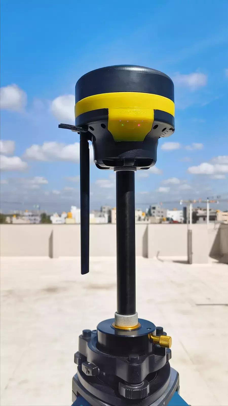
Fast, Easy Setup — Anywhere You Go
Setup Made Simple
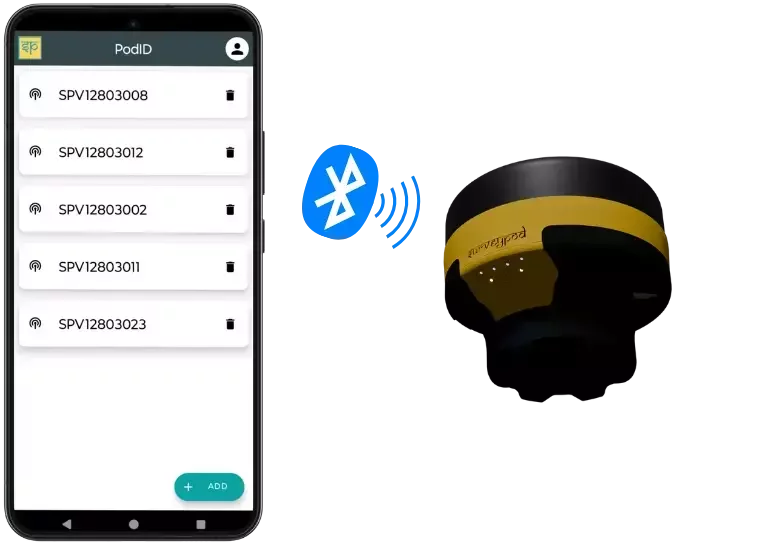
1. Power On & Connect
2. Select Correction Source
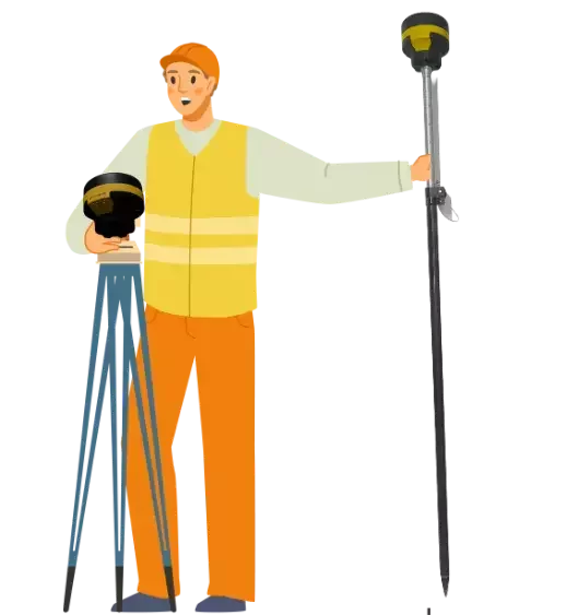
3. Start Surveying
Fast, Easy Setup — Anywhere You Go
Setup Made Simple
1. Power On & Connect
2. Select Correction Source

3. Start Surveying
Fast, Easy Setup — Anywhere You Go
Setup Made Simple
1. Power On & Connect
2. Select Correction Source
3. Start Surveying
MULTI CONSTELLATION
TRACKING UPTO 92 SATELLITES
CORS NETWORK
HIGH ENDURANCE
ALL WEATHER CHAMPION
Surveypod Spec Sheet
Precision and Accuracy
Real Time Kinematic (RTK) Mode (H: 7 mm | V: 14 mm)
Post Processing Kinematics (PPK) Mode (H: 5 mm | V: 8 mm)
Static Mode (H: 4 mm | V: 6 mm)
Tracked Signals
GPS/QZS/SBAS L1C/A | L2C
GLONASS L1OF | L2OF
GALILEO E1B/C | E5b
BEIDOU B1I | B2I
Data Format
Correction Data Format RTCM3 | NTRIP
Position Data Format CSV | DXF
RAW Data Format RINEX
Advanced Device Parameters
Satellite Tracking up to 92 Satellites
Update Rate up to 10 Hz
Logging Rate 1 Hz Logging of RINEX data
Satellite Use up to 32 Satellites
Storage 32 GB
Specification Sheet
Specification Sheet
MULTI CONSTELLATION
Utilize GPS, GLONASS, Galileo, and BeiDou for enhanced reliability and accuracy. Benefit from better satellite visibility and performance in challenging environments.
TRACKING UPTO 92 SATELLITES
Our DGNSS is engineered to track upto 92 satellites. This capability ensures exceptional accuracy and reliability by leveraging signals from other GNSS systems.
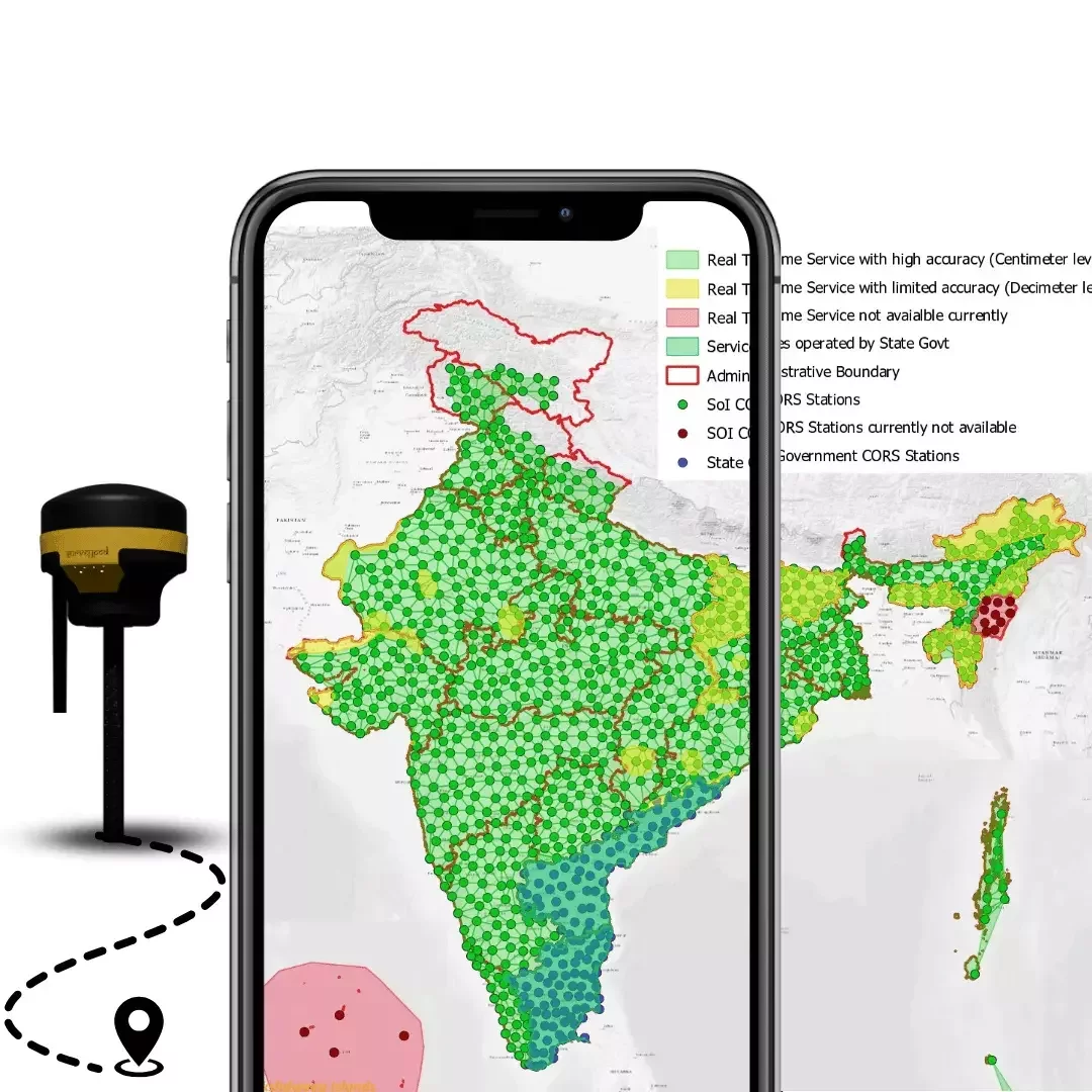
CORS NETWORK
Our DGNSS solution, powered by a comprehensive CORS network, provides centimeter-level positioning accuracy, ideal for critical applications such as surveying, percison agriculture and construction
HIGH ENDURANCE
SurveyPod works up to 16 hours on single charge. It also has facility to connect external power which further extends working hours
ALL WEATHER CHAMPION
SurveyPod is designed to work in coldest of winter to hottest summer without any interruption. Thanks to its robust heat management system
MULTI CONSTELLATION
Utilize GPS, GLONASS, Galileo, and BeiDou for enhanced reliability and accuracy. Benefit from better satellite visibility and performance in challenging environments
TRACKING UPTO 92 SATELLITES
Our DGNSS is engineered to track upto 92 satellites. This capability ensures exceptional accuracy and reliability by leveraging signals from other GNSS systems.
CORS NETWORK
Our DGNSS solution, powered by a comprehensive CORS network, provides centimeter-level positioning accuracy, ideal for critical applications such as surveying, percison agriculture and construction
HIGH ENDURANCE
SurveyPod works up to 16 hours on single charge. It also has facility to connect external power which further extends working hours
ALL WEATHER CHAMPION
SurveyPod is designed to work in coldest of winter to hottest summer without any interruption. Thanks to its robust heat management system
RTK & PPK: When Should you Choose?
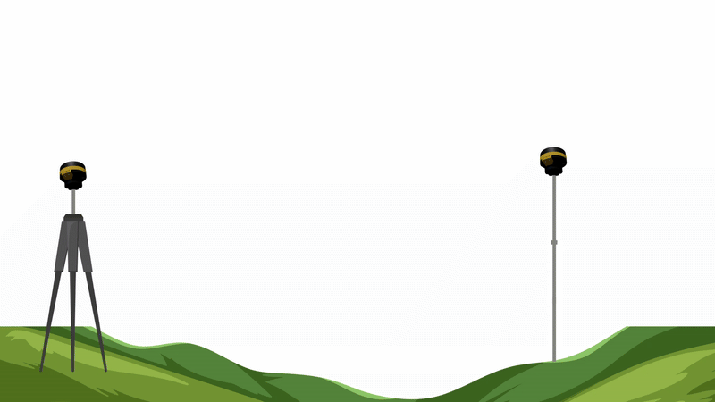
Real Time Kinematic (RTK)
RTK provides immediate, high-accuracy GNSS positioning by using real-time correction data from a base station making it ideal for instant access to accurate coordinates
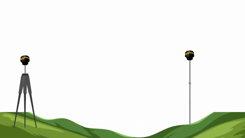
Post Processing Kinematic (PPK)
PPK applies GNSS corrections after data collection, making it ideal for environments where real-time signals are unreliable
| Feature | RTK | PPK |
| Requires Internet/Radio | Yes | No - Works entirely offline |
| Signal Reliability | May drop in poor coverage areas | Works even with signal loss |
| Processing Time | Instant / Live | Requires Time |
| Field Efficiency | Faster field decisions and feedback | Decisions made during processing |
RTK & PPK: When Should you Choose?
Real Time Kinematic (RTK)
RTK provides immediate, high-accuracy GNSS positioning by using real-time correction data from a base station making it ideal for instant access to accurate coordinates
Post Processing Kinematic (PPK)
PPK applies GNSS corrections after data collection, making it ideal for environments where real-time signals are unreliable
| Feature | RTK | PPK |
| Requires Internet/ Radio | Yes | No - Works entirely offline |
| Signal Reliability | May drop in poor coverage areas | Works even with signal loss |
| Processing Time | Instant / Live | Requires Time |
| Field Efficiency | Faster field decisions and feedback | Decisions made during processing |
Features
Gets RTK fix in seconds
SurveyPod gets RTK fixed solutions in seconds and maintain high accuracy in harsh and challenging environment
16 hrs on Full Charge
SurveyPod works up to 16 hours on single charge.It aslo has facility to connect external power which further exteneds working hours
Data Formats
Seamlessly integrate with your existing workflow. The receiver supports a wide range of industry-standard formats.
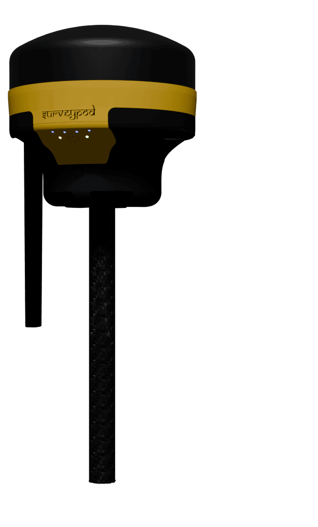
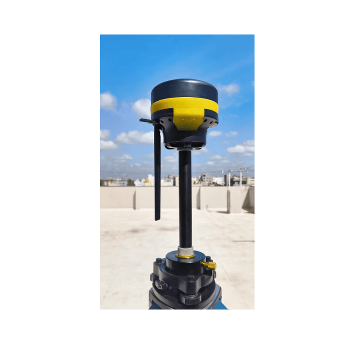
Compact & Rugged
Build for durability in rough field conditions and for surveyors on the move. Engineered to withstand field challenges
Features
Gets RTK fix in seconds
SurveyPod gets RTK fixed solutions in seconds and maintain high accuracy in harsh and challenging environment
16 hrs on Full Charge
SurveyPod works up to 16 hours on single charge.It aslo has facility to connect external power which further exteneds working hours
Data Formats
Seamlessly integrate with your existing workflow. The receiver supports a wide range of industry-standard formats.
Compact & Rugged
Build for durability in rough field conditions and for surveyors on the move. Engineered to withstand field challenges

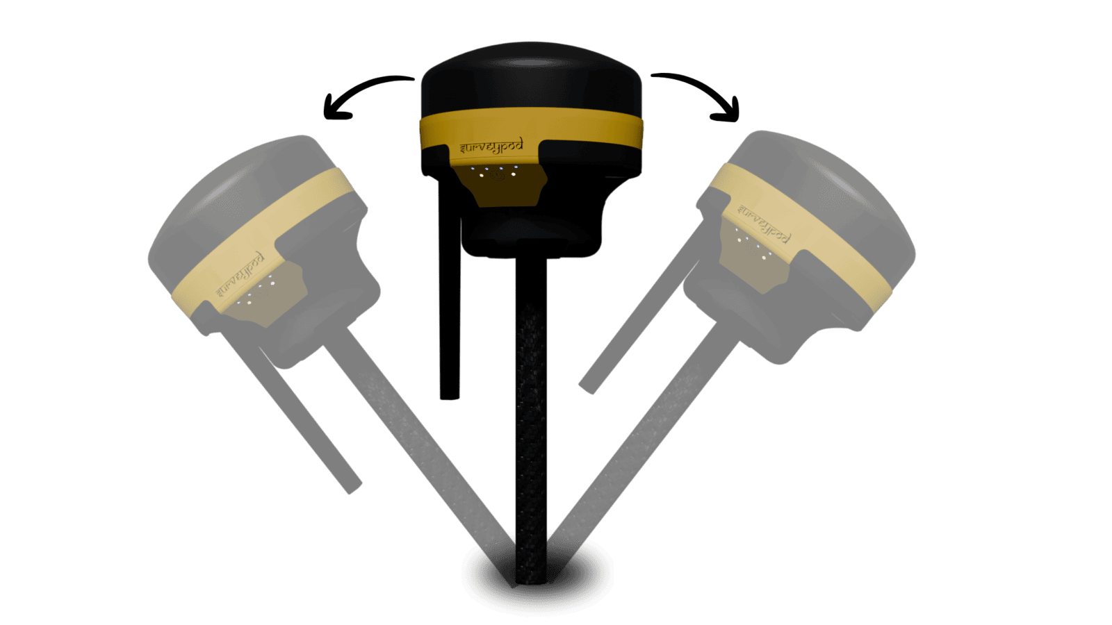
Stop Wasting Time Leveling
— Tilt is Here
No need to keep the pole perfectly vertical. Our DGNSS system with Tilt Compensation lets you capture accurate points even when the receiver is tilted — saving time, reducing effort, and making it easier to survey tough terrain or obstacles.
Forget the bubble. With built-in tilt compensation, you can collect accurate GNSS points without holding the pole perfectly vertical — even on slopes, near walls, or in tricky spots.
Our advanced DGNSS receiver lets you survey confidently without perfect leveling. Tilt up to 60° and still get centimeter-level precision — speeding up your workflow and reducing fatigue.
Stop Wasting Time Leveling—Tilt is Here
No need to keep the pole perfectly vertical. Our DGNSS system with Tilt Compensation lets you capture accurate points even when the receiver is tilted — saving time, reducing effort, and making it easier to survey tough terrain or obstacles.
Forget the bubble. With built-in tilt compensation, you can collect accurate GNSS points without holding the pole perfectly vertical — even on slopes, near walls, or in tricky spots.
Our advanced DGNSS receiver lets you survey confidently without perfect leveling. Tilt up to 60° and still get centimeter-level precision — speeding up your workflow and reducing fatigue.
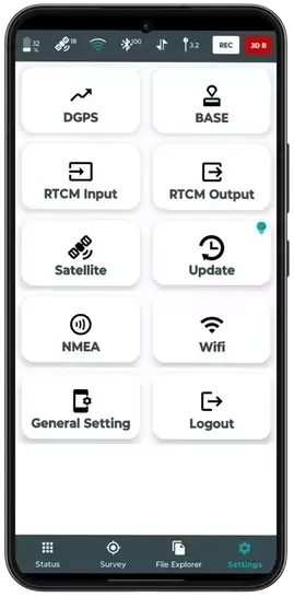
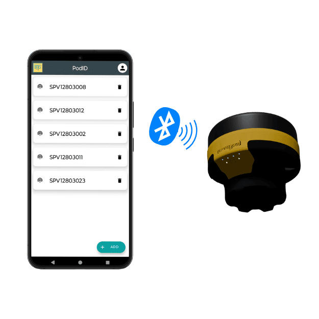
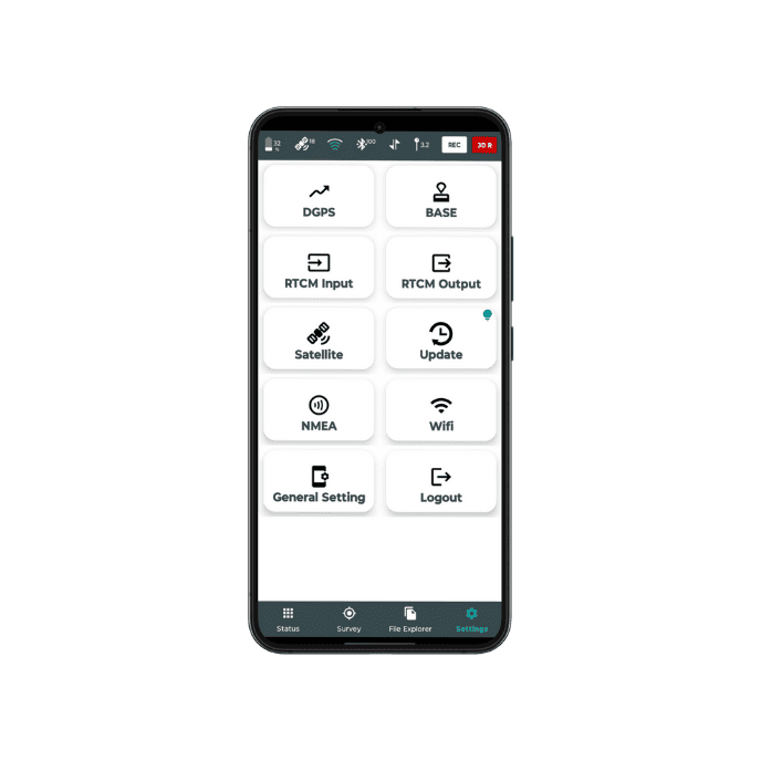
Multiple Connectivity Options
Stay connected and accurate—anywhere, anytime.
Our DGNSS system is designed to offer unmatched flexibility with multiple connectivity options. Whether you're working in a remote field or a connected city, choose the method that best suits your surveying environment and workflow.
Long-Range, Low-Power Data Transmission
LoRa Module
Integrated with LoRa (Long Range) technology for efficient, low-power communication over extended distances. Perfect for rugged or large survey areas where power efficiency and range matter most.
Max Transmission Power: 1W
ISM 868/915MHz Band
Upto 5 km Range
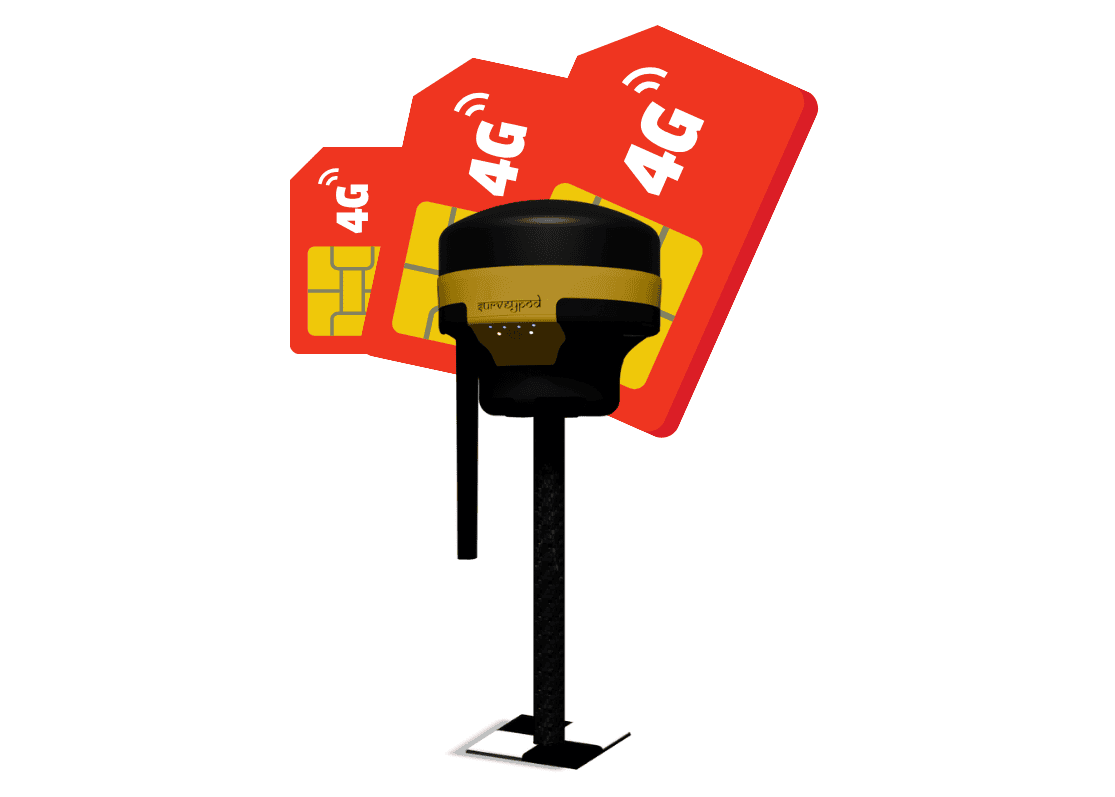
RTK Corrections via Cellular Networks
Internet
Connect via 4G or Wi-Fi to access RTK corrections over the internet. This mode expands your operational range and eliminates the need for physical base setups.
Range: 60km
Enhancing Accuracy Without Setting Up a Base
CORS Ready
Access real-time corrections from authorized CORS stations. Work more efficiently by skipping base station setups and relying on trusted infrastructure.
Network-Based RTK Corrections
No Physical Base Station Required
Wider Coverage Area
Consistent High Accuracy
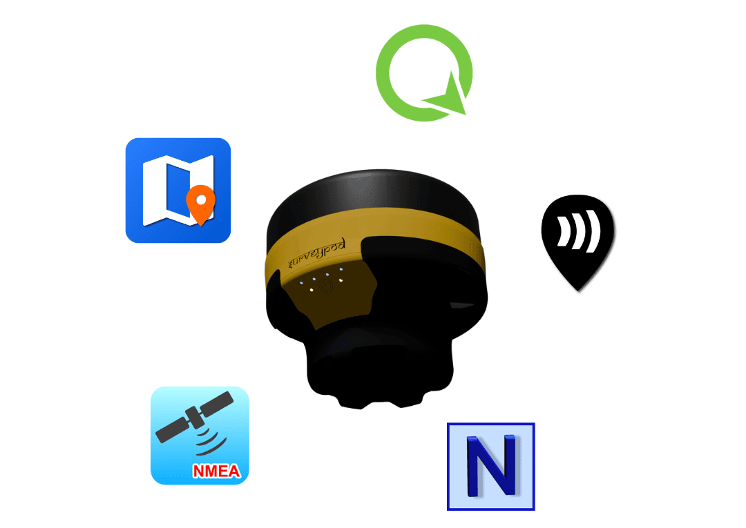
Seamless NMEA Integration for Maximum Compatibility
NMEA Support
Output standard NMEA data in real-time to a variety of platforms - GIS & mapping tools - ensuring maximum compatibility and workflow integration.
Connect External GNSS
Load Your Own Maps
Share & Export Data
Measurement Tools
Data Collection
Multiple Connectivity Options
Stay connected and accurate—anywhere, anytime.
Our DGNSS system is designed to offer unmatched flexibility with multiple connectivity options. Whether you're working in a remote field or a connected city, choose the method that best suits your surveying environment and workflow.
Long-Range, Low-Power Data Transmission
LoRa Module
Integrated with LoRa (Long Range) technology for efficient, low-power communication over extended distances. Perfect for rugged or large survey areas where power efficiency and range matter most.
Max Transmission Power: 1W
ISM 868/915MHz Band
Upto 5 km Range
RTK Corrections via Cellular Networks
Internet
Connect via 4G or Wi-Fi to access RTK corrections over the internet. This mode expands your operational range and eliminates the need for physical base setups.
Range: 60km
Enhancing Accuracy Without Setting Up a Base
CORS Ready
Access real-time corrections from authorized CORS stations. Work more efficiently by skipping base station setups and relying on trusted infrastructure.
Network-Based RTK Corrections
No Physical Base Station Required
Wider Coverage Area
Consistent High Accuracy
Seamless NMEA Integration for Maximum Compatibility
NMEA Support
Output standard NMEA data in real-time to a variety of platforms - GIS & mapping tools - ensuring maximum compatibility and workflow integration.
Connect External GNSS
Load Your Own Maps
Share & Export Data
Measurement Tools
Data Collection