
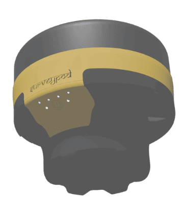
Surveypod
DGNSS Tilt
No Bubble, No Trouble
Forget the bubble - our DGNSS system with tilt support let you focus on the job, not the angle
DGNSS Tilt
No Bubble, No Trouble
Forget the bubble - our DGNSS system with tilt support let you focus on the job, not the angle
DGNSS Tilt
No Bubble, No Trouble
Forget the bubble - our DGNSS system with tilt support let you focus on the job, not the angle
DGNSS Tilt
No Bubble, No Trouble
Forget the bubble - our DGNSS system with tilt support let you focus on the job, not the angle
Normal DGNSS vs Modern Tilt DGNSS

Say Goodbye to Bubble
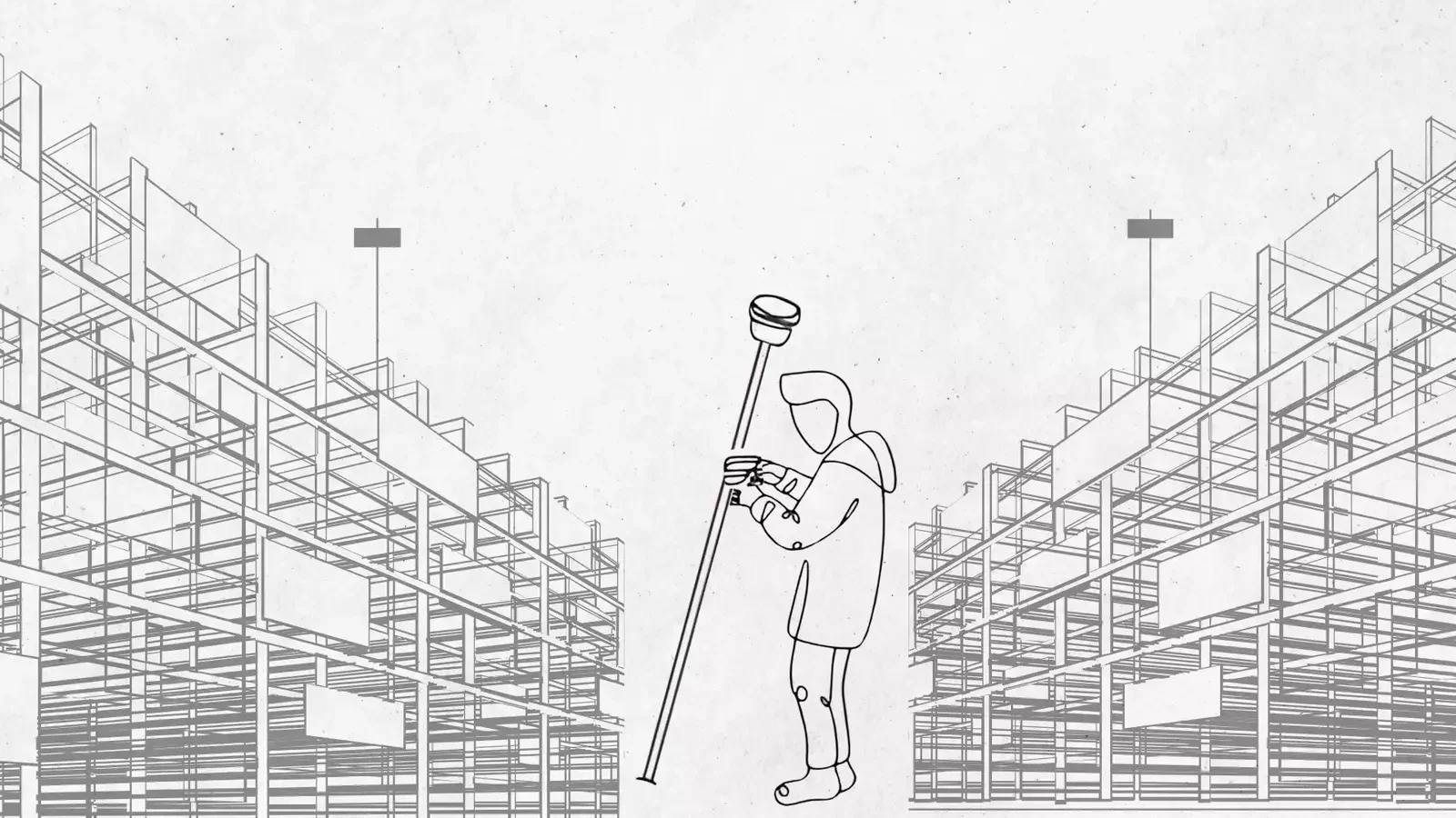
In traditional GNSS surveying, every point demands a perfectly vertical pole. Surveyors spend time adjusting bubble levels, especially in rough terrain, which slows down work and increases fatigue. The moment your pole deviates from vertical—even slightly—your positional accuracy is at risk.
Update to Tilt Enabled DGNSS
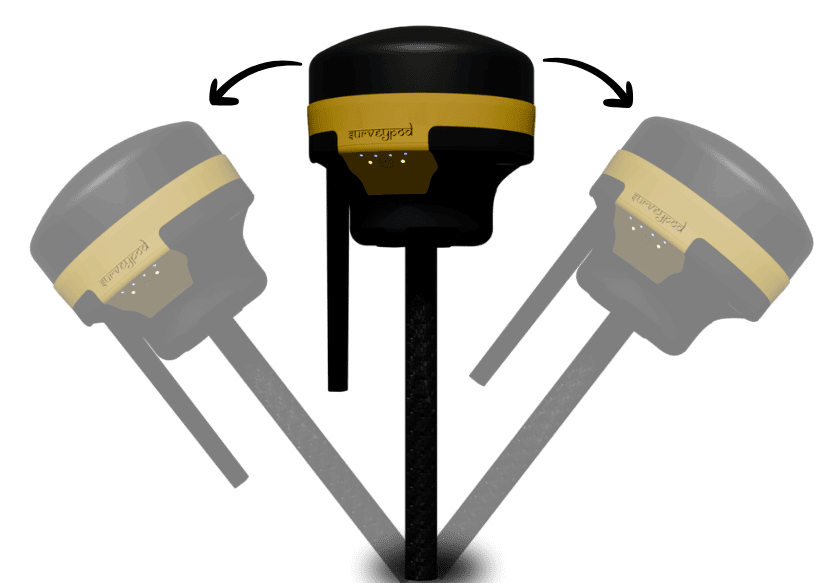
With theModern DGNSS, powered by an advanced Inertial Measurement Unit (IMU), you can collect accurate GNSS points even when the pole is tilted—up to 60°. This isn’t just convenience. It’s a revolution in field efficiencyThis isn’t just convenience. It’s a revolution in field efficiency
FEATURES
Pole Must be Vertical ?
Bubble Level Required ?
Time
Hard Terrain
Fatigue
Normal DGNSS
Yes
Mandatory
Slower
Difficult or Impossible
Higher Physical Strain
DGNSS with TILT
No
Not Needed
Faster
Possible with Tilt Technology
Reduced due to less adjustment
Normal DGNSS vs Modern Tilt DGNSS
Say Goodbye to Bubble
In traditional GNSS surveying, every point demands a perfectly vertical pole. Surveyors spend time adjusting bubble levels, especially in rough terrain, which slows down work and increases fatigue. The moment your pole deviates from vertical—even slightly—your positional accuracy is at risk.
Update to Tilt Enabled DGNSS
With theModern DGNSS, powered by an advanced Inertial Measurement Unit (IMU), you can collect accurate GNSS points even when the pole is tilted—up to 60°. This isn’t just convenience. It’s a revolution in field efficiency.
| FEATURES | Normal DGNSS | DGNSS with TILT |
| Pole Must be Vertical ? | Yes | No |
| Bubble Level Required ? | Mandatory | Not Needed |
| Time | Slower | Faster |
| Hard Terrain | Difficult or Impossible | Possible |
| Fatigue | Higher Physical Strain | Less Strain |
Normal DGNSS vs Modern Tilt DGNSS
Say Goodbye to Bubble
In traditional GNSS surveying, every point demands a perfectly vertical pole. Surveyors spend time adjusting bubble levels, especially in rough terrain, which slows down work and increases fatigue. The moment your pole deviates from vertical—even slightly—your positional accuracy is at risk.
Update to Tilt Enabled DGNSS
With theModern DGNSS, powered by an advanced Inertial Measurement Unit (IMU), you can collect accurate GNSS points even when the pole is tilted—up to 60°. This isn’t just convenience. It’s a revolution in field efficiencyThis isn’t just convenience. It’s a revolution in field efficiency
| FEATURES | Normal DGNSS | DGNSS with TILT |
| Pole Must be Vertical ? | Yes | No |
| Bubble Level Required ? | Mandatory | Not Needed |
| Time | Slower | Faster |
| Hard Terrain | Difficult or Impossible | Possible |
| Fatigue | Higher Physical Strain | Less Strain |
Unlock the Power of IMU Tilt with SurveyPod
Experience the future of smart surveying—go beyond traditional limits and survey with confidence, speed, and accuracy.

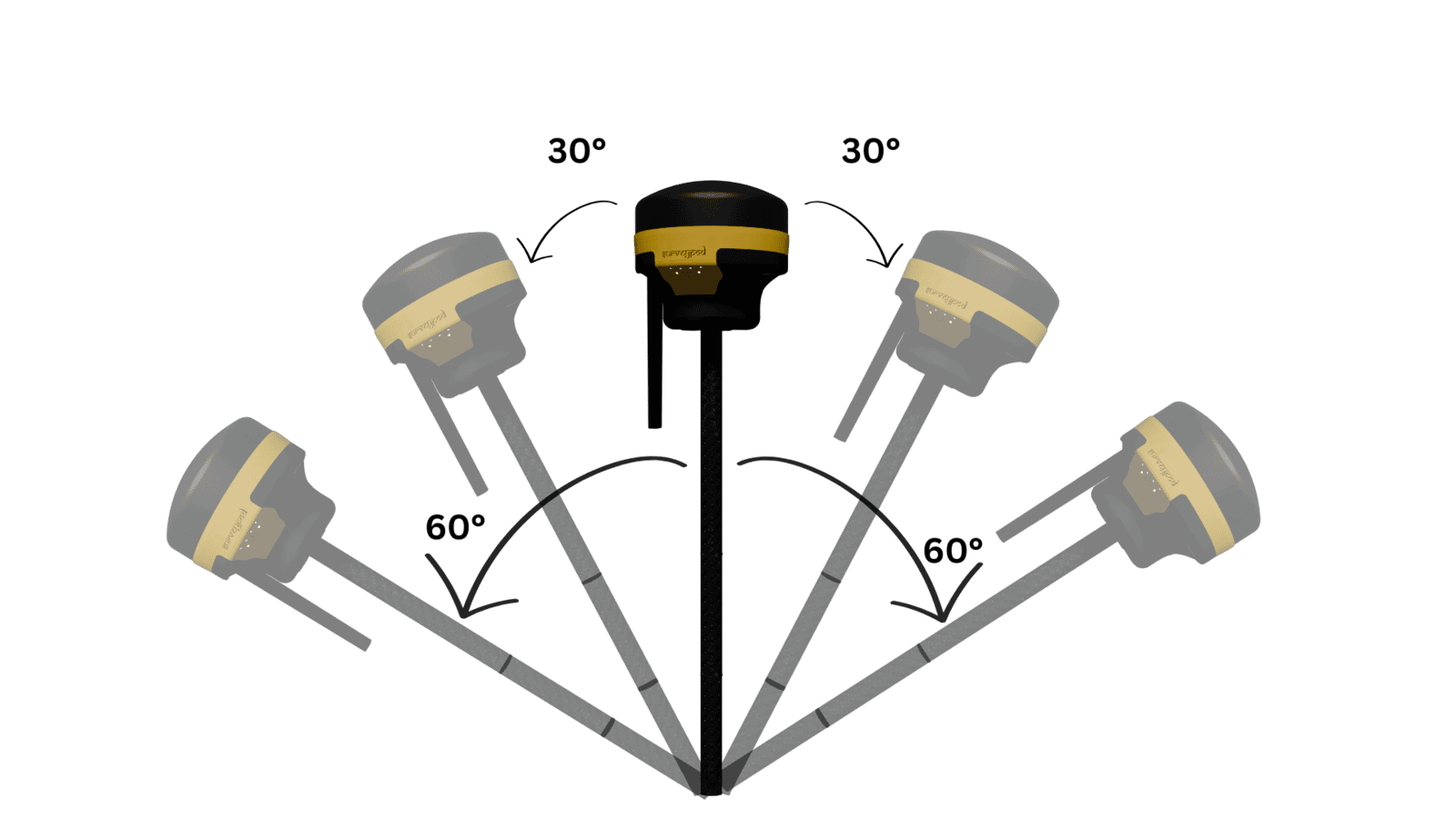
Tilt Angle
| Up to 60° in any direction |

Tilt Accuracy
| 1cm upto 30° tilt angle & 5cm upto 60° tilt angle |

Initialization Time
| 1 second (95%) |
Unlock the Power of IMU Tilt with SurveyPod
Experience the future of smart surveying—go beyond traditional limits and survey with confidence, speed, and accuracy.
Tilt Angle
Upto 60° in any direction
Tilt Accuracy
1 cm upto 30° tilt angle and 5 cm upto 60° tilt angle
Initialization Time
1 second (95%)
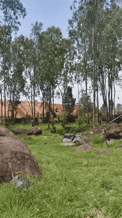
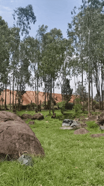
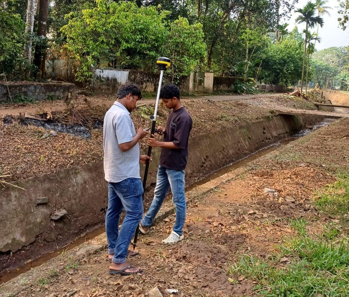
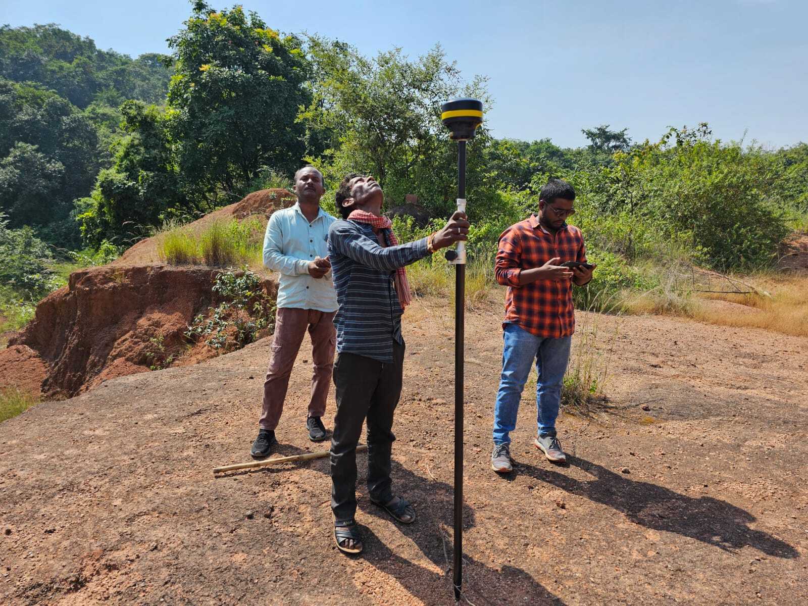
Rugged. Reliable. Real-World Ready.
Whether you're on slopes, in forests, or construction zones, the IMU keeps your work smooth, safe, and professional.
Land Layout
Without Tilt,
it’s a
hassle
Traditional GNSS makes you fight terrain. Adjusting the bubble level for every point can be a tedious task
With Tilt, its just Aim, Tilt & Record
The SurveyPod automatically accounts for the angle, making fieldwork drastically faster.
Not every point is easy to reach.
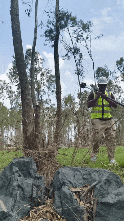
Hard to reach? Not with Tilt.
Fences, slopes, walls, or uneven terrain often make surveyors skip or delay data collection.
But with SurveyPod’s tilt-enabled DGNSS, even the toughest locations are accessible.
No bubble-leveling. No compromise on accuracy.
Rugged. Reliable. Real-World Ready.
Whether you're on slopes, in forests, or construction zones, the IMU keeps your work smooth, safe, and professional.
Land Layout
Without Tilt,
it’s a
hassle
Traditional GNSS makes you fight terrain. Adjusting the bubble level for every point can be a tedious task
With Tilt, its just Aim, Tilt & Record
The SurveyPod automatically accounts for the angle, making fieldwork drastically faster.
Not every point is easy to reach.
Hard to reach? Not with Tilt.
Fences, slopes, walls, or uneven terrain often make surveyors skip or delay data collection.
But with SurveyPod’s tilt-enabled DGNSS, even the toughest locations are accessible.
No bubble-leveling. No compromise on accuracy.
Rugged. Reliable. Real-World Ready.
Whether you're on slopes, in forests, or construction zones, the IMU keeps your work smooth, safe, and professional.
Without Tilt,
it’s a hassle
Traditional GNSS makes you fight terrain. Adjusting the bubble level for every point can be a tedious task
With Tilt, its just Aim, Tilt & Record
The SurveyPod automatically accounts for the angle, making fieldwork drastically faster.
Not every point is easy to reach
Hard to reach? Not with Tilt.
Fences, slopes, walls, or uneven terrain often make surveyors skip or delay data collection.
But with SurveyPod’s tilt-enabled DGNSS, even the toughest locations are accessible.
No bubble-leveling. No compromise on accuracy.
Rugged. Reliable. Real-World Ready.
Whether you're on slopes, in forests, or construction zones, the IMU keeps your work smooth, safe, and professional.
Without Tilt, it’s a hassle
Traditional GNSS makes you fight terrain. Adjusting the bubble level for every point can be a tedious task
With Tilt, its just Aim, Tilt & Record
The SurveyPod automatically accounts for the angle, making fieldwork drastically faster.
Not every point is easy to reach
Hard to reach? Not with Tilt.
Fences, slopes, walls, or uneven terrain often make surveyors skip or delay data collection.
But with SurveyPod’s tilt-enabled DGNSS, even the toughest locations are accessible.
No bubble-leveling. No compromise on accuracy.
Client Testimonials
The SurveyPod DGNSS has completely transformed our field operations. With its centimeter-level RTK accuracy, we’ve reduced survey time by over 40%. It performs flawlessly even in tough terrain, and the setup is incredibly user-friendly.
Centrepoint Surveyors - Kerala
The build quality is solid, and the battery life easily lasts through full-day surveys. It’s a dependable tool for serious surveyors.
Jodhpur Minetech - Rajasthan
SurveyPod helps us map farm boundaries quickly and accurately. It works well even in rural areas with poor signal. The receiver connects easily and gives consistent results every time
Vertex Mining Services - Madhya Pradesh